Creating Custom Maps — Quickstart
This guide walks you through creating your first ATAK map source XML file and submitting it to the repository. For the full element specification, see the MOBAC XML Reference.
Create Your First Map Source
1. Find a tile server URL.
Public tile servers publish tiles in a {z}/{x}/{y} URL pattern. Common
sources include OpenStreetMap
and government GIS portals (USGS, NOAA, state agencies).
2. Create the XML file.
Every customMapSource requires three elements: name, url, and maxZoom.
Adding minZoom, tileType, and backgroundColor is recommended.
3. Complete example — OpenTopoMap:
<?xml version="1.0" encoding="UTF-8"?>
<customMapSource>
    <name>OpenTopo - Opentopomap</name>
    <minZoom>1</minZoom>
    <maxZoom>17</maxZoom>
    <tileType>png</tileType>
    <url>https://a.tile.opentopomap.org/{$z}/{$x}/{$y}.png</url>
    <backgroundColor>#000000</backgroundColor>
</customMapSource>
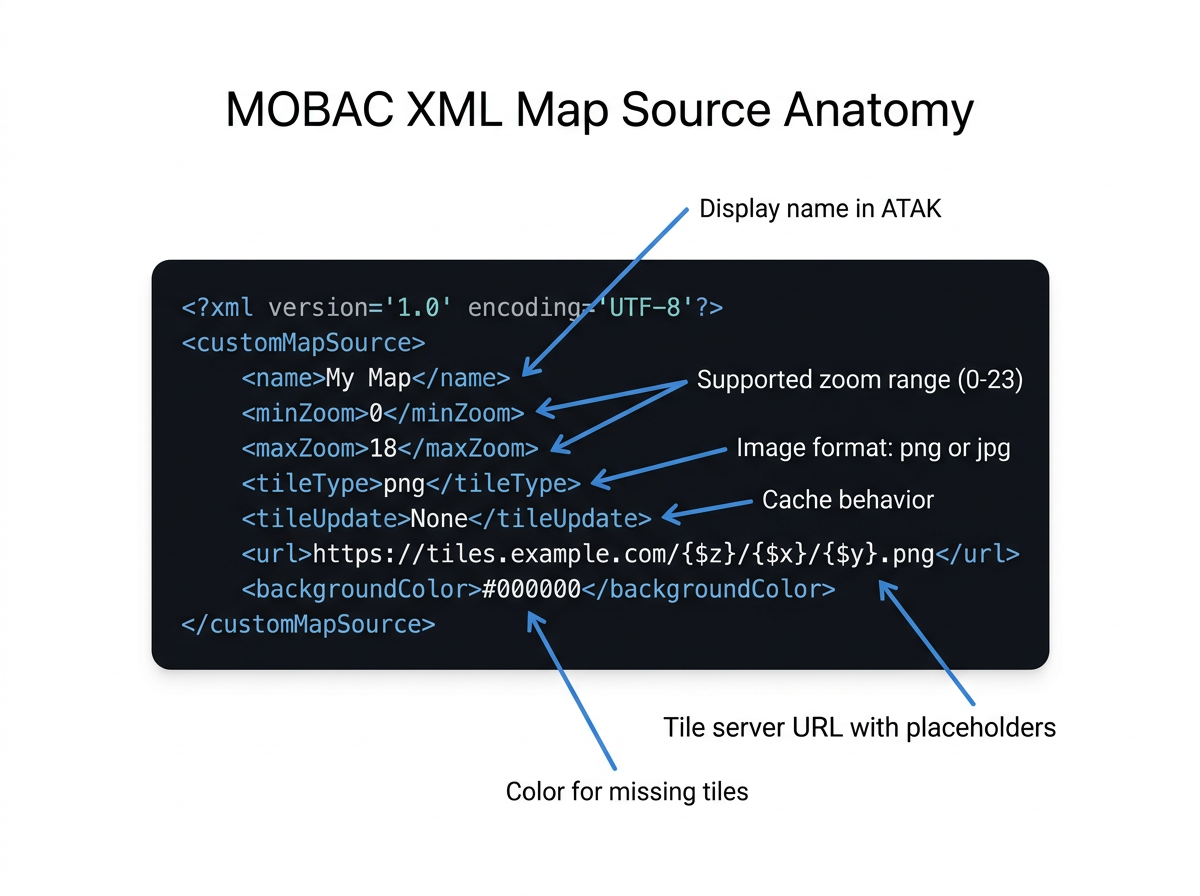
Key points:
- {$z}, {$x}, {$y} are replaced with tile coordinates at runtime.
- tileType should match what the server returns (png or jpg).
- maxZoom must not exceed the server's actual max zoom level.
Test It
- Copy the XML file to your device at
atak/imagery/mobile/mapsources/. - Open ATAK and look for your map name in the source list.
- Pan and zoom to verify tiles load correctly.
See the Install Guide for detailed installation instructions and alternative methods.
Submit to ATAK-Maps
- Fork this repository and create a branch.
- Add your XML file under the appropriate provider directory (e.g.,
opentopo/for OpenTopoMap sources). - Use conventional commit format:
feat: add <map name>. - Open a pull request.
See CONTRIBUTING.md for full contribution guidelines.
Next Steps
- MOBAC XML Reference — WMS sources, multi-layer composites, server load balancing, coordinate systems, and all element details.
- Install Guide — All the ways to load map sources onto your device.